 DISTRIBUIDOR CERCANO
 PARTNER CENTER
 MENÚ
MENÚ
 Español
 GNSS RTK
 Óptico
 GIS
GIS Hidrografía & Oceanografía
 CORS & Posicionamiento Preciso
 Software
 Laser & MMS
 UAV
UAV
 Infraestructura GNSS
 Posicionamiento en el Interior
 Conducción Automática
 Monitoreo Automático
 Control de Máquinaria
 Agricultura de Precisión
 Equipos UAV de Precisión
 Mapeo Móvil
 Antena GNSS
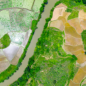
 Topografía & Ingeniería
 Sistema de Información Geográfica
 Escaneo 3D & Mapeo Aéreo
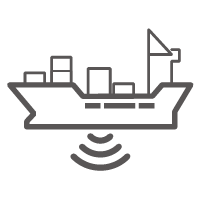 Producto Marino
 Servicio de Corrección Global
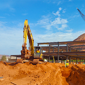
 Partner Center
 FAQ
FAQ
 Próximos Eventos
 Noticias
 Boletín Informativo
 Webinar
 Acerca de Nosotros
 Distribuidores Cercanos
 Enviar una Cotización
 Socios Estratégicos
 Únase a Nosotros
 Hágase Socio
Thank you for your interest in Hi-Target. We will contact you soon.
A fast and revolutionary hydrographic solution used in channel survey
 2020-11-13
Compartir con:


A fast and revolutionary hydrographic solution used in channel survey
SUMMARY
In the world there are many unreachable, dangerous or inconvenient places that are required to survey such a the tailing ponds, narrow channels, ultra-shallow water ponds and barrier lakes and so on. However, how to survey in a safer and faster way is always the question to the modern world. USV, short for Unmanned Surface Vehicle, is a revolutionary platform that can carry all kinds of sensor for hydrographic survey. In this paper, two specified application of USV are shared and discussed.
1. BACKGROUND AND TRADICITONAL MARINE HYDROGRAPHIC SURVEY
Water is a basic elementary but amazing thing for the all creatures on earth. To human, it feeds and raise the civilization. In every great ancient and historical civilization, you will find at least one important river that furnishing the land and giving the support to the society. Nowadays, more than 95% of the human residencies (city, towns and villages) are established by rivers, brooks, and wells. As the industry revolution emerging from the 1st to the 4th, more and more interaction between human and water are involved; more bridges are crossing the river; more ports and harbor are under construction for economic and social purposes.
Meanwhile, new technologies of hydrographic surveying served for the civil engineering such as multi-beam echo sounder, side scan sonar, sub-bottom profiler and even LiDAR for topographic and hydrographic purposes greatly contribute to the work for public authorities and private sectors all over the world.
However, many administrative departments and authorities of water and traffic are facing the great challenges when designing or implementing the design of the city as the urbanization and urban renewal are on their way in a fast speed.
In the past old days, when the surveyors are going to survey the depth of the water, the first thing they have to do is to find and rent boats or ships locally which are always costly. Then the heavy echo sounder and other accessories will put on the boat, finding a proper position to mount the transducer which will require lest interference from the water waves and engine propellers. What’s more, the surveyors have to take care of the actual depth because the water might be too shallow for the boat to float. In case of being stranded, some surveyors might try to hire the bamboo raft or small sampan (small and lightweight boat), which can work perfectly on the shallow water but lack facilities to protect the staff's life and they are easy to be capsized by the waves created by the big ship or torrents. For some occasions, the surveyors need to survey the barrier lakes after the earthquake, the polluted water or even monitor the water level of the tailings ponds.

Some more flexible solutions are needed when surveying the lake in the island where you cannot easily convey a boat there. Similar requirements are also claimed by the surveying tasks on the brooks, which might contain shallow shoal and dams from the upper stream to lower stream. So in these sentences, surveyors are facing the challenges of the safety, accuracy and efficiency challenges.
Here in this paper some projects from China as the solution examples are provided for reference.
2. HEAVY TRAFFIC CHANNEL SURVEYING
2.1 Project background

Pearl River Delta, intertwined within the water network, and products of richness, now had become one of the most important and main economic engine and industry area in China since 1979. More than 30% of the "made in China" goods are produced or assembled there and exported to all over the world. The water network and hundreds of harbors have been playing a very important role in goods export and raw material import. There was a plan to build some more pipelines for the electricity gas and municipal water across some channels. Before laying the pipelines, the constructor must survey the channels to get the latest water bed situation. One of the main channels that the pipelines are going to cross is called "Modao Gate Channel". 89.5 KM long with more than 30 ports and thousands of factories, 45 million cargo volume and 70,000 boundings, have brought this 3000 tonnage vessel level channel more than 800 vessels daily on the water. Thus, it would be quite difficult for the safety of the surveyors as they had to sail the boat or ship across the river to do the cross-section survey and there is no traffic light on the channel to sort out the heavy traffic.
Task goals:
-To finish a hydrographic survey within 20 cm accuracy
-5 channels where the pipelines are going to pass
Challenges:
-Cross section survey is easy to slow down the busy heavy traffic and even causing accidents
-Impossible to survey the shallow area
-High cost for periodically channel survey
2.2 USV system, an ideal solution for the project
2.2.1 USV iBoat BM1
The Unmanned Surface Vehicle, also known as USV, is an ideal solution for the surveyors to finish the work on time without threats to their security.
This USV, named iBoat BM1, can work for more than 12 hours continuously. With the auto pilot function providing the precision survey, gap between each surveying lane can be preciously implemented (within 10 cm offset). What’s more, the boat can be easily sail back automatically when the signal is lost or the battery is insufficient for the coming work, according to the pre-setting multiple home points. The real time camera data transmission can help surveyors who are on the bank keep monitoring the boat.
This advanced and autonomous system consists of the vessel body, excellent echo sounding module and positioning module. Of course, the data communication system and the controlling system are included.
2.2.2 Project Planning
Firstly, designing the survey lanes backgrounded by online Google satellite images on the USV pilot software. The interval and length of each cross section lane can be easily implemented. The Unmanned Surface Vehicle, also known as USV, is an ideal solution for the surveyors to finish the work on time without any matters on their security.

2.2.3 Auto-pilot and manual control
When the USV started to work, it will sail automatically or manually, users can switch the working mode in real time. In this surveying task, the USV turned away to avoid the heavy ships easily as soon as the controller was sending the interception command into manual mode. The flexibility and swift performance guarantee the lightweight boat's safety and efficiency, which offering a lower risk job than the human surveying.
2.2.4 Real time surveying data transmission
The data will be transmitted form the boat to the laptop software where the user can easily monitor the position, heading, depth and control the parameter setting for the sounding system on the safe bank area.

2.2.5 Surveying Result
The data will be transmitted from the boat to the laptop software where the user can easily monitor the position, heading, depth and control the parameter setting for the sounding system on the safe bank area.

2.2.6 Boat deployment and shipment
The data will be transmitted from the boat to the laptop software where the user can easily monitor the position, heading, depth and control the parameter setting for the sounding system on the safe bank area.
3. LONG RIVER WHERE TIME AND SHALLOW WATER MATTERED
Even it is not deep enough to carry the big ships, Hun River, which called the "Mother River", is still important to the Shenyang City, the capital of Liaoning Province, due to the vital resource for municipal water supplement, surrounding the city like a belt, greening the city with artificial waterfront parks. Yearly and monthly, the Water Resource Authority of Shenyang City need to monitor the hydrographic condition in seasons for civil security, waterfront part maintenance and sustainable developing study. However, it couldn't be implemented by traditional hydrographic survey because there are several dams existing and lots of shoal hiding from the source of the river(a big reservoir) to the downstream area——the Shenyang City, which might bring a lot of trouble for boat arrangement, transportation and safety. Therefore, USV had become an ideal solution for the surveying.
Task Requirement:
–To finish a hydrographic survey with 20 m section interval
–Total length of the surveying part of the river is 80km so the surveying lane may be up to 1000km
–To finish the project as soon as possible within a month
With the help of the USV iBoat BM1, the job was done within 14 days, which is a dramatically improvement comparing to the traditional way.

4. CONCLUSION
Unmanned Surface Vehicle is a smart platform that can help people to finish the project safely and fastly, widely used for the rivers, busy channels, shallow water, lakes and reservoir dut to its lightweight, strong body design and autonomous systems.
Anterior: Hydrographic Survey USV Helps with Volume Acquisition in Lake Regions
NEXT: NONE
Site Map  ©2020 Hi-Target and/or its subsidiaries and affiliates. All rights reserved.

©2020 Hi-Target and/or its subsidiaries and affiliates. All rights reserved.