 DISTRIBUIDOR CERCANO
 PARTNER CENTER
 MENÚ
MENÚ
 Español
 GNSS RTK
 Óptico
 GIS
GIS Hidrografía & Oceanografía
 CORS & Posicionamiento Preciso
 Software
 Laser & MMS
 UAV
UAV
 Infraestructura GNSS
 Posicionamiento en el Interior
 Conducción Automática
 Monitoreo Automático
 Control de Máquinaria
 Agricultura de Precisión
 Equipos UAV de Precisión
 Mapeo Móvil
 Antena GNSS
 Topografía & Ingeniería
 Sistema de Información Geográfica
 Escaneo 3D & Mapeo Aéreo
 Producto Marino
 Servicio de Corrección Global
 Partner Center
 FAQ
FAQ
 Próximos Eventos
 Noticias
 Boletín Informativo
 Webinar
 Acerca de Nosotros
 Distribuidores Cercanos
 Enviar una Cotización
 Socios Estratégicos
 Únase a Nosotros
 Hágase Socio
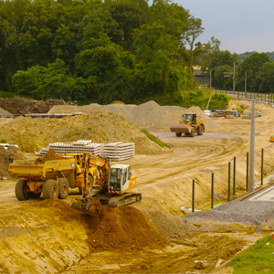
Thank you for your interest in Hi-Target. We will contact you soon.
Hydrographic Survey USV Helps with Volume Acquisition in Lake Regions
 2021-06-07
Compartir con:


Hydrographic Survey USV Helps with Volume Acquisition in Lake Regions
Adin Li,
Hi-Target International Group Limited
CLICK HERE TO DOWNLOAD THIS CASE STUDY
The hydrographic survey in the lakes and canal regions is not an easy job in the past. Lacking professional and portable surveying equipment and mobile platform, the precision and accuracy are always not reliable enough.
The process is also complicated and time-consuming. A real USV survey case took place in a lake in Thailand and Hi-Target hydrographic USV has successfully collected dependable results. It helps to calculate the volume in which data are much closer to the real in less time.
Geography
Pathumthani lies on the low alluvial of the Chao Phraya River that flows through the capital city. It is one of the most populated provinces in Thailand. There are lots of canals and lakes that distribute around the city, feeding the local planting and fishery industries.

Project Task
Human beings are becoming more and more ambitious — they want more space for development purposes. Therefore, the relationship between humans and waters, canals and lakes had never become so tightened as that in modern time. For example, in the land-reclamation project in this article, the authority planned to fill a small lake for commercial use after the environmental evaluation. Thus, it is necessary to carry out the marine mapping to calculate precisely the earth for the project.
Challenges
- 1. Close due date.
The construction site has to finish in 1 month and thus it has higher demand on efficiency.
- 2. Safety risks
As this region was once a big area of swamp and full of muddy alluvial, the safety of the surveyor is hard to guarantee when walking into the water to finish the marine mapping. Besides, the soft lakebed and other unknown risk factors may cause accidents as well.
- 3. Limited budget.
This was the most vital factor to consider. The project manager had to prepare enough earth to fill in the lake without redundancy, which can save cost and reduce waste. A reliable result of the lake’s depth and width, which is not easily distorted by wrong signals, brought by the USV survey can help him estimate the amount of earth needed more accurately.
Hi-Target BS Series USV
Equipped with a slim body, modularized parts and a safety guidance system (auto-pilot), Hi-Target USV is a convenient mobile platform of professional survey system with stable performance for hydrographic survey. The onboard echosounder is an exclusive design for the BS series boat, with high reliability preserved, as shown in the workflow below.
Workflow
- 1. Environment investigation. Make sure that there aren’t any distinct obstacles or hidden objects on and under the surface of the water, for that they may threaten the boat’s sailing during the USV survey. Then mark the different points between the satellite map and the real scenario, and then find a proper deployment point accordingly.
- 2. Setup the communication between the laptop ashore and the boat before putting it on the water by radio.
- 3. Deploy the boat on the water, make it sail along the border; and then design the survey lane in the safe zone.

- 4. Make the boat sail and survey in auto-pilot mode, and switch to manual mode if necessary on some special occasions.

- 5. Correct the depth data in the post-processing procedure of the USV survey. Taking the results of this project as an example. In the picture below, the green lines and the little blue bubbles are the raw depth data recognized by the echosounder, while the red waves are the echogram that shows the true signal feedback from the water bottom. To reduce the occurrence of wrongly-recognized depth and get results closer to the real, surveyors must read the echogram to align the raw depth data; or the results will be unreliable.

Key Benefits
High Efficiency
The small surveying equipment is agile enough to turn its body swiftly and go for shorter distancing survey lanes to provide more real data, which allows surveyors to finish the bathymetry work of the hydrographic survey within less time.
Reliable Results
With the help of professional post-processing software, the raw depth will be overlaid on the echogram and the real depth can be aligned by reducing the wrong signals.
Safety Guarantee
USV survey helps surveyors get rid of risks since they can operate the boat ashore rather than adventuring in the water for marine mapping.
Results
Hi-Target Hi-MAX software processed the depth data and filled the contour as a terrain preview.

User’s Comment
This project is very important for my team. We want to get a result as accurate as we can while reducing the cost at the same time. Hi-Target USV and the professional software system had truly given me confidence on site. I believe that the reliable earthwork result created by the Hi-Target USV survey will help to reduce the cost of the truckload and soil.

LAST: NONE
Posterior: A fast and revolutionary hydrographic solution used in channel survey
Site Map  ©2021 Hi-Target and/or its subsidiaries and affiliates. All rights reserved.

©2021 Hi-Target and/or its subsidiaries and affiliates. All rights reserved.